Site Stats
Survey Method
Wading GNSS + Drone LiDAR
Current status
1.2 ft Depth of Cover
Bank Risk
Likely to Fail
Scour Potential
Very High
Pipeline Points
88 Depth Points
Photos taken
32 Photos Taken on Site
Drone DEM
848,250 ft2 Mapped Area
Explore the aerial Survey Data
To use the model:
- 360° Inspection:
- Rotate: Left-click and drag your mouse left or right to spin the model around the center point.
- Pan: Right-click and drag to move the camera laterally across the channel.
- Zoom: Scroll with your mouse wheel to inspect features closer.
- Dual-Mode Analysis:
- Aerial Imagery View: High-resolution photogrammetric overlay that reveals land cover, vegetation, and existing infrastructure.
- Topographic View: Elevation-based terrain modeling that quantifies depth, channel morphology, and slope gradients.
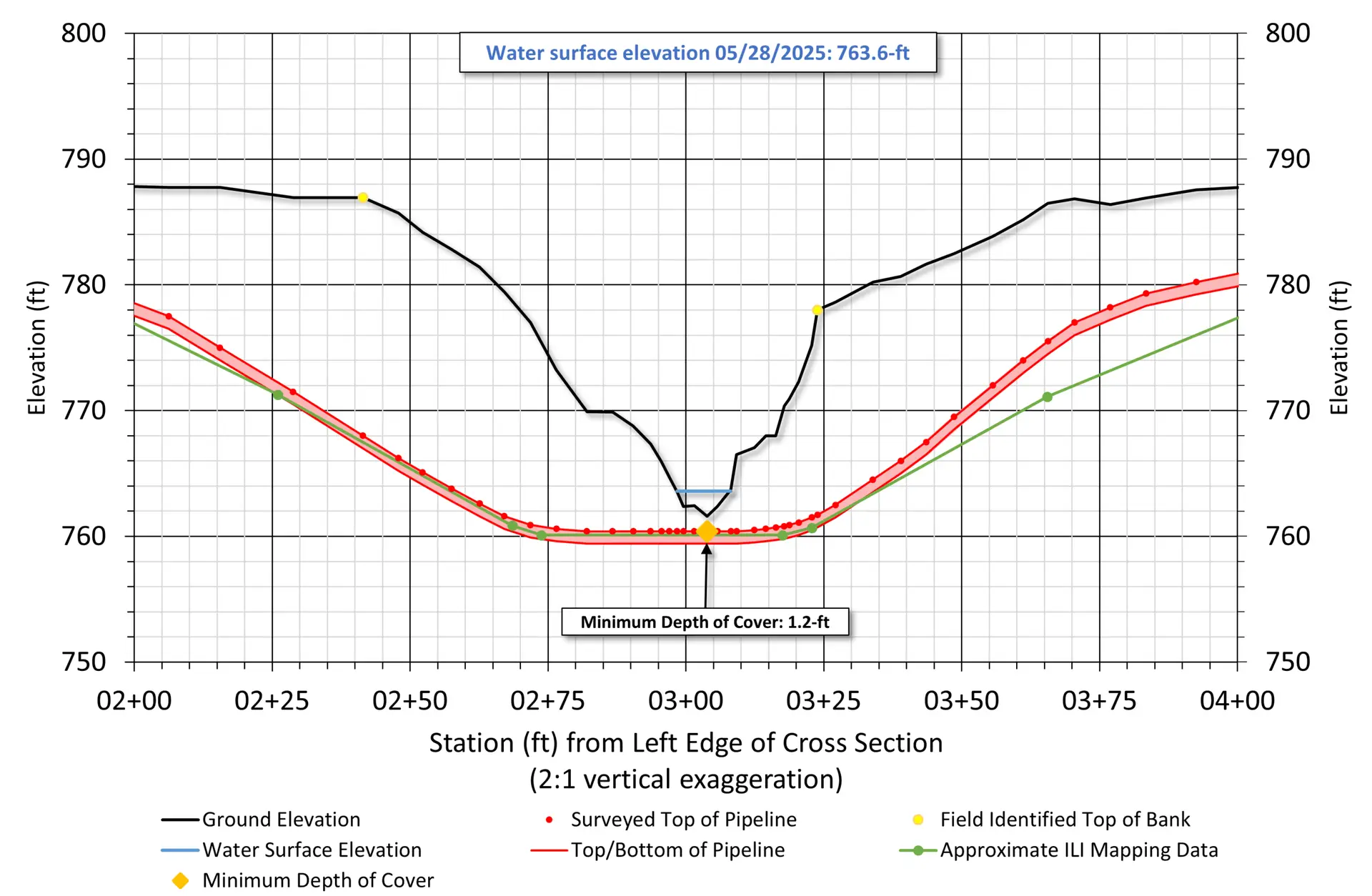
Depth of Cover Profile
This cross-section illustrates the ground elevation captured during a manual wading survey (black line) compared to the surveyed top of pipeline (red points). The survey highlights the current channel profile and identifies a localized minimum depth of cover of 1.2 feet.
Scour Depths
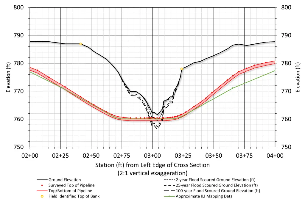
Although the pipeline is currently buried, our modeling shows that even a common 2-year flood has enough energy to wash away the riverbed and expose the pipe. Because exposure is predicted during this frequent type of storm, the risk is even greater during larger 25-year and 100-year floods, which could leave the pipeline unsupported and hanging across the channel.
Scour Depths with large woody debris
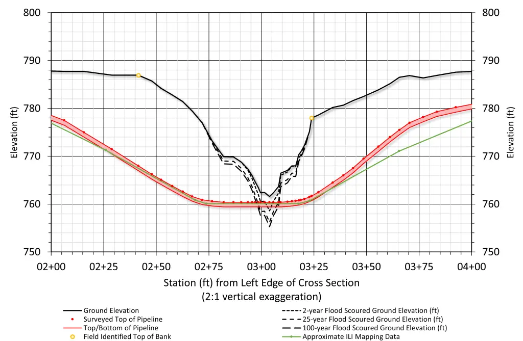
We evaluated how ‘Large Woody Debris’ (like fallen trees) would impact the riverbed. The results show that the pipeline will likely be exposed during a 2-year flood if debris is present. Because the pipe is buried just over a foot deep, even frequent storms can cause enough localized scour to reach the asset. Larger floods would result in more severe exposure and potential spanning, where the pipeline is left suspended in the water column.
predicted bank migration
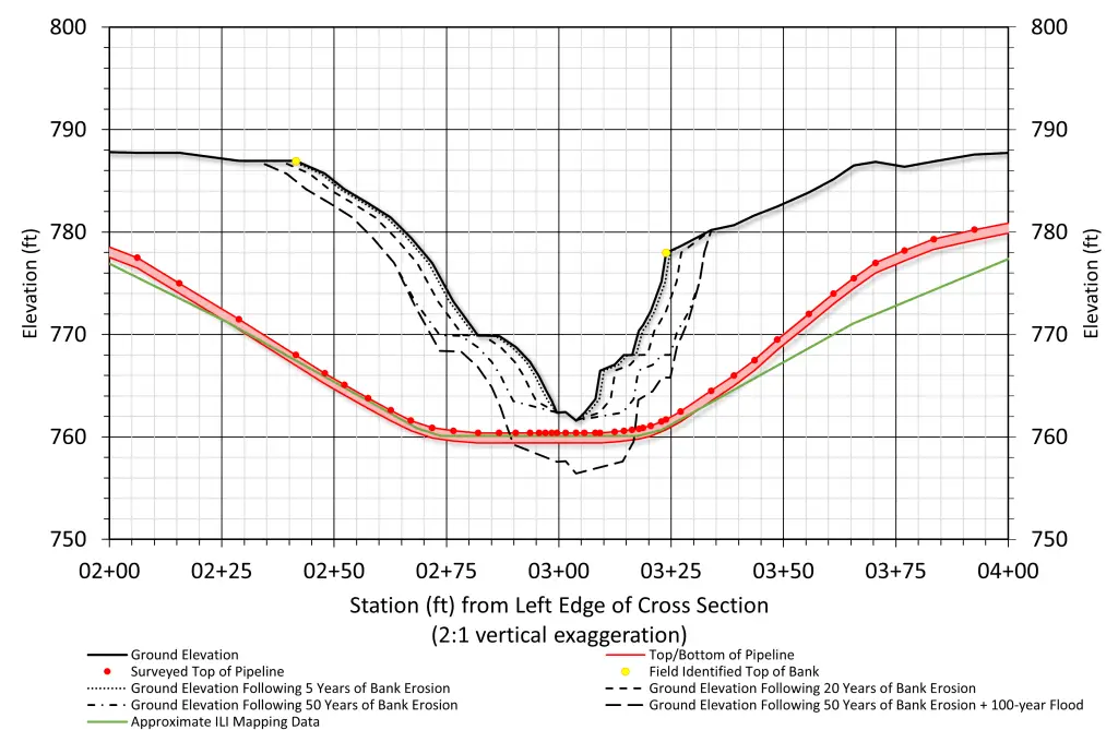
We mapped the lateral movement of the channel based on the calculated widening rate of 0.2 feet per year on both sides. This migration erosion steadily reduces the soil covering the pipeline landward of the current water line. Over time, the ‘safe’ buried zones get smaller. The modeling suggests that 50 years of this natural widening—combined with a major flood—would likely shift the channel edges far enough to leave the pipeline vulnerable and exposed.